
Cold, rain and even snow. Not only in the next few days but the trend is announced for the entire second half of April. This is what Lorenzo Tedici, meteorologist of the website www.iLMeteo.it, states, according to which, with a Scandinavian outbreak we will have a drop in
temperatures of 15°C in the maximum values and locally even 17° less compared to the exceptional heat of the weekend
.
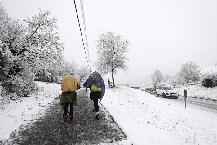
"The polar air - he underlines - will enter Italy in the next few hours. The first effects will be observable in the North-East with thunderstorms and possible hail, while in the South we will still have the remains of a North African depression with some scattered rain". The drop in temperatures will begin in the evening and will affect the whole country tomorrow. The collapse will be more marked in the eastern area, with maximum temperatures falling widely below 20°C. Not only that: the snow will return to whiten the Alps and the Apennines, from Tuscany to Molise, up to 1000 meters above sea level.
In particular, Wednesday 17 April will see a more widespread worsening in the centre-south with mainly showers or thunderstorms: the north will remain temporarily protected by the Alpine chain, without significant rain but already with a significant drop in temperatures. On Thursday 18th the precipitation will be snowy in the Apennines above 1000 metres. Showers and thunderstorms will affect the entire country in a patchy pattern, leaving only the Major Islands clear and drier. Even in the Alps the snow will be widespread above 900-1100 meters. Friday will be the photocopy of Thursday.
In detail:
- Tuesday 16. In the north: worsens in the Northeast with strong thunderstorms and hailstorms. Middle: Mostly sunny. In the south: showers on Sicily, Calabria, Lucania and Puglia.
- Wednesday 17. In the north: afternoon instability in the Triveneto. In the center: thunderstorms and rain more likely on the mountains and on the Adriatic side. In the south: unstable weather with frequent showers especially on the peninsulas.
- Thursday 18. In the north: rainy in Emilia Romagna, Lombardy and Triveneto. Middle: Very unstable with showers. In the south: unstable weather with thunderstorms especially on the peninsulas.